The Clue
So let's wrap this up with the clue and location. "Not yet a duo on their way to the LP ... but He passed by in October 1803." This was solved pretty easily by a few DK players with their answer of "Meriwether Lewis".

... and who were York and Seaman?

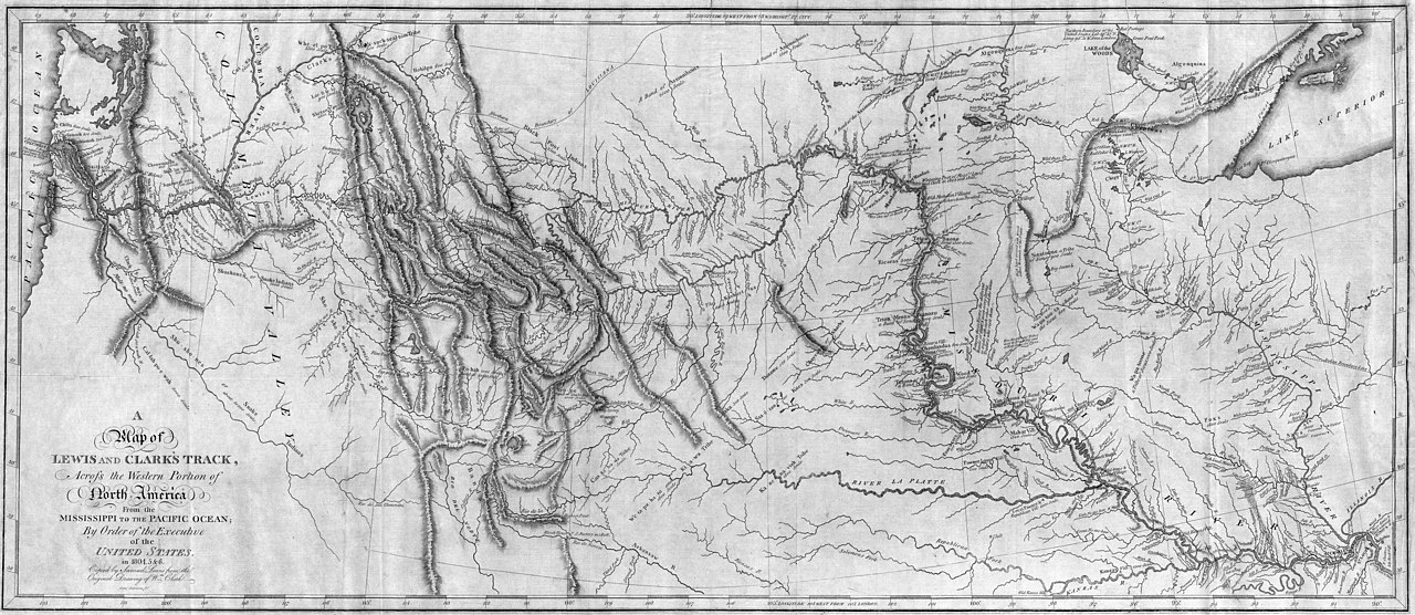 Wikipedia - Map of Lewis and Clark's Track Across America
Imagine ... it's post American Revolution. It's post Constitution. It's Thomas Jefferson and this new republic has him anxious about the possibilities in store for this country. Among his continued work toward establishing "life, liberty and the pursuit of happiness" apart from British rule, he has a head full of "could be's." One of those visions was an all-water trade and travel route from the Pacific Ocean to the Atlantic Ocean.
It's almost hard to imagine that a coast to coast route of nicely black-topped road did not exist a short 225 years ago. So, Jefferson did not have Google Maps, he did not have a print-off from Mapquest, he didn't even have a Rand McNally Atlas of the States. No one did. Much of the west was only "claimed" by other countries; the French, the Spanish, the British. Indiana wasn't yet Indiana. No one had a detailed knowledge of getting from Point A on the Pacific to point B on the Atlantic. America as a whole was unknown to most everyone, including the natives.
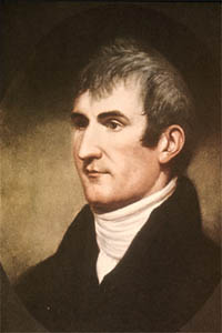 Wikipedia - Meriwether Lewis portrait by Charles Wilson Peale
So, he and his personal secretary, Captain Meriwether Lewis began plans for the "The Corps of Volunteers for North Western Discovery" or "Corps of Discovery", which much later became known as the "Lewis and Clark Expedition." Its main purpose was to find that route connecting the East and West coasts. But why go that far just to connect "sea to shining sea"? Jefferson and Lewis made it a point to include gathering knowledge about the plants, the animals, the hydrology, and the native tribes of the "unexplored" west.
Wikipedia - Meriwether Lewis portrait by Charles Wilson Peale
So, he and his personal secretary, Captain Meriwether Lewis began plans for the "The Corps of Volunteers for North Western Discovery" or "Corps of Discovery", which much later became known as the "Lewis and Clark Expedition." Its main purpose was to find that route connecting the East and West coasts. But why go that far just to connect "sea to shining sea"? Jefferson and Lewis made it a point to include gathering knowledge about the plants, the animals, the hydrology, and the native tribes of the "unexplored" west.
This journey did not start with "a single step" and actually only started with Lewis and a small crew. It started by keelboat in Pittsburgh on August 31, 1803. Journals puts Meriwether Lewis arriving in Clarksville, Indiana on October 14, 1803. This would have him passing by Vevay around the 7th, as the 70 mile distance could be done in about a week. He met up with his co-captain, William Clark while in Clarksville, Indiana to gather supplies and more men. From Clarksville on is where most of the story-worthy parts of the journey occurred. It took them 2 years, 4 months and 10 days to travel approximately 7689 miles.
There isn't room here to recreate the Expedition's stories, but if you have time, research a few of my favorite shorts from the mission. They include:
After reading further, you'll quickly find no references to Vevay or Switzerland County whatsoever. Indirectly, though, the Lewis & Clark Expedition caused greater expansion west, which did bring more settlers to our area. But before that, the groundwork was being laid by the Dufour's and existing settlers, and I can imagine a spattering of folks along the banks waving (aaannnddd possibly readying their protections ) as the beginnings of this famous mission passed by.

So let's wrap this up with the clue and location. "Not yet a duo on their way to the LP ... but He passed by in October 1803." This was solved pretty easily by a few DK players with their answer of "Meriwether Lewis".
The location stumped quite a few. I provided an additional clue last week by telling my followers to focus more on the "passed by" portion of the clue. Within a few days, it was cracked as being the "Ohio River" and the key was found. It was placed under the slip railing just off the boat ramp in Vevay. The Ohio River flooded, as it tends to do, after the key was placed in December. This key was underwater for roughly 2 weeks, but the mighty Ohio did not see it necessary to take the key with it. I'm grateful, it made the game that much more fun.
Listen to the reverence this treasure hunter has for Meriwether Lewis' quick passby of Switzerland County. Listen to how he involves his family. Why create a treasure hunt like Dufour's Keys in a small town in Indiana? This right here! Enjoy!